Spectar
Product Design and Design Team Management at Spectar.

How might we enhance the UX so construction professionals can save time by getting to work faster and install more accurately than ever before?

Getting to work faster
We designed a model alignment method that delivers over 75% faster performance and enhances accuracy by 90% compared to our previous approach.

Adaptable for all
We made a version of the same alignment method that requires no additional equipment or human resources to set up, for teams with limited resources.

Spectar is a fully-immersive Augmented Reality Building Information Model (BIM) overlay app for the Microsoft HoloLens, geared specifically towards the construction industry. Spectar addresses frontline construction workers by bringing BIM onsite and in AR, to make data available on their terms without the need for BIM skills. By visualizing the model, critical data, and contextual history in place, construction workers are able to communicate and work faster and more accurately.

My Role
Produce Design Manager
What are we solving for?
Construction workers need a faster, simpler way to set up Spectar so they can start working on-site without delay.
Why?
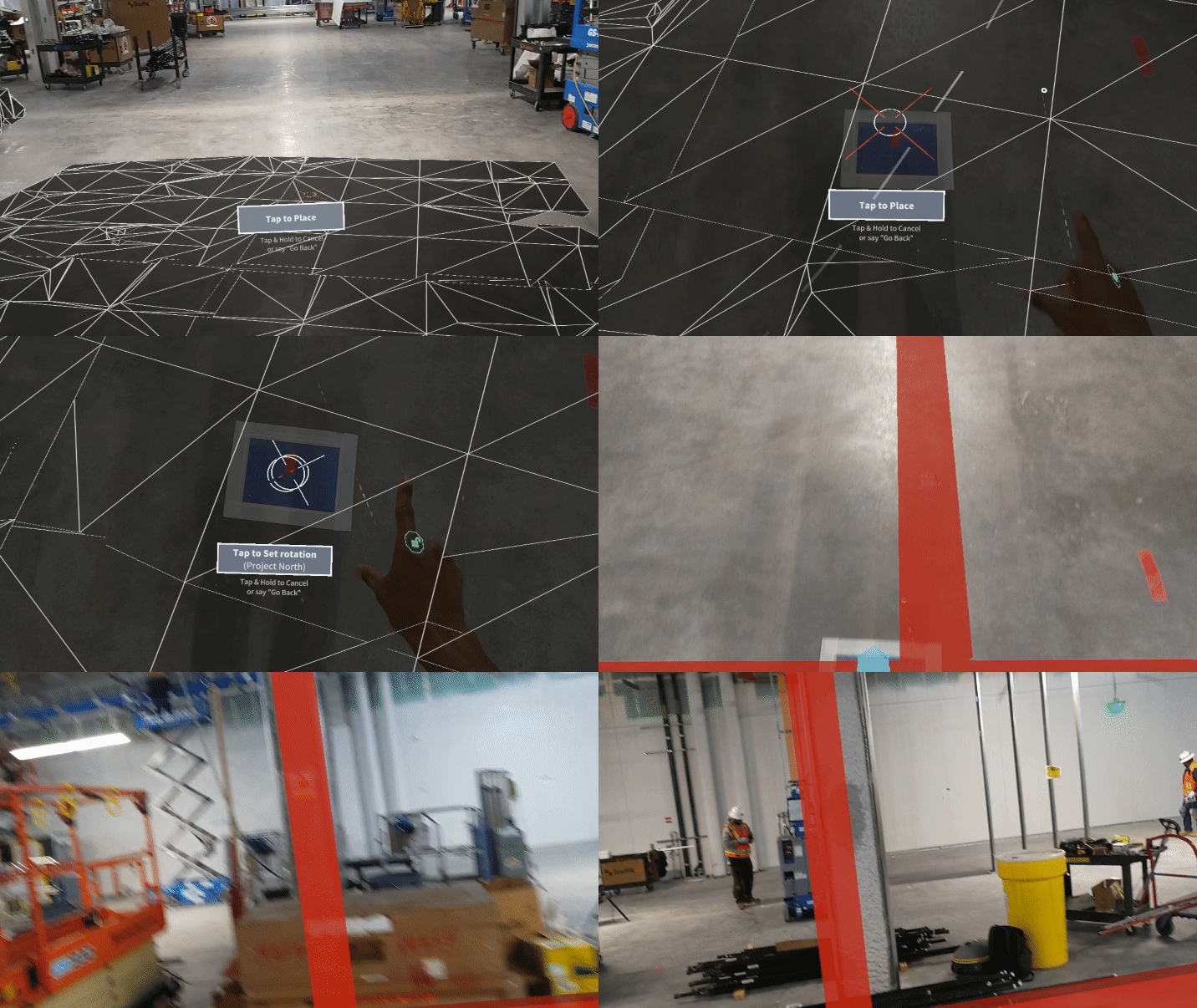
Spectar’s product, available at the time, allowed users to choose specific targets from a floor plan and use a virtual crosshair to manually align the target to a physical point marked on the floor of a construction site.
This alignment method uses a single point, an “anchor”, that users can nudge and rotate to achieve an alignment that looks good to their naked eye.

What were the setbacks?
Prone to Manual User Error
The model is only as accurate as the user’s eye and ability to nudge and rotate the anchor, time spent fine-tuning, etc.
No Persistence
The model needs to be placed manually with every new session
No Shared Alignment
The same models on separate devices will rarely have the same alignment
Time Intensive
The time it takes to align the model depends on how precise the user wants to be but it requires cross-checking frequently with the environment which can take up to 1 minute on average
Model Drift
Aligning a large model to one point in the physical environment naturally means the model will become less accurate, the further the user moves away from the anchor
What did we design?
Given the usability setbacks experienced by customers, we designed a novel alignment solution we called, “Multi-Point Alignment” or MPA, that significantly increased the accuracy and precision of the model, thereby improving the UX.

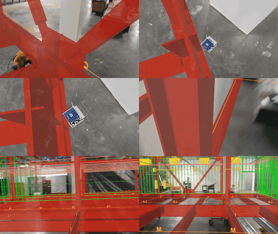
MPA utilizes virtual spatial anchors that track multiple physical points throughout a construction site in order to correct for drift and keep the model aligned to the physical environment.
In addition to reducing setup time for construction workers on site, we were able to significantly improve precision by leveraging multiple QR codes that serve as anchors. The HoloLens scans and automatically aligns to the QR codes.
Making it accessible to all teams
While designing this solution, we considered a variety of setup methods to ensure MPA is both accessible and easy to deploy across a multitude of settings (e.g., varying team sizes, budgets, and requirements for setup speed, accuracy, and deployment). The two setups are referred to as the Survey and Adhoc Alignment methods.
Survey Method (Optimized for Accuracy)
Construction companies who want to achieve the greatest level of accuracy can use a surveying team or a device called a Total Station, a surveying instrument with electronic distance measurement to measure both vertical and horizontal angles and the slope distance from the instrument to a particular point, to measure and record points on multiple QR codes placed throughout sites. The surveying team will then need to export the recorded points and upload them into Spectar’s web portal to combine with the BIM model. Once this setup is complete, any user can turn on their HoloLens and scan any QR code to load and align to the correct BIM model. This process is highly accurate (up to a sixteenth of an inch at each anchor) though more resource-intensive, given this method requires the involvement of a survey team, equipment, and a BIM team to combine the recorded points with the model.
Adhoc Alignment Method (Optimized for Flexibility in Lower Resource Settings)
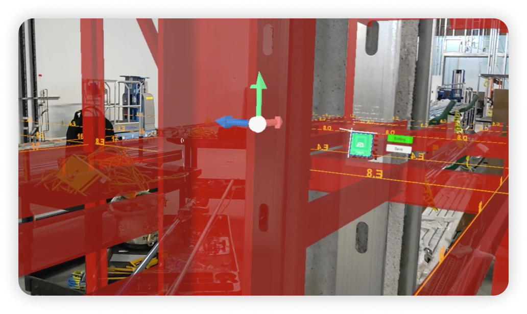
Construction teams without access to a surveying team or a Total Station device can use the HoloLens alone to set up the workspace, align the model and save the model position via QR codes. The Adhoc Alignment Method skips the prep steps, requires little user input to get positioning right, is persistent so users don't have to do it every time, and is changeable when necessary (users can remove codes that are no longer valid and add new ones as needed).
Our Adhoc Alignment Method design requires no additional equipment or human resources to set up. This setup method also allows for a highly adaptable workflow, which is important for users in constantly changing construction settings. QR codes are prone to being covered by fireproofing as well as being damaged by heavy-duty equipment like forklifts and new installations. The Adhoc Alignment Method thus allows our users to add new QR codes and save new anchor points without requiring assistance from the survey and BIM teams.

Key results
Saved 4.5 minutes per user, per session on average
Achieved being within an inch of accuracy
Won Spectar’s design team the Red Dot Design Award in 2022
